Click on any image for a larger view
 |
| Molas Pass |
After breakfast we pack our essentials; clothing, laptops,
and camera gear. Food goes in last. We stuck with our regular plan of cooking
everything at home, only having to thaw, then heat our meals each evening. Unfortunately, our camper doesn’t have a
freezer big enough for all our meals, so some of our prepared meals stay
home. Don’t worry we won’t starve.
The landscape has greatly changed since our last adventure. What were wildflower-lined roads, are now roads lined with brown skeletons of wildflowers. Even the weeds seem to be having a hard time with the heat and drought, they are the only things that are green, although not the usual, healthy green. Heading towards Lubbock the ground changes to the color of terra cotta, then back to nondescript brown. It’s only 94° in Lubbock as we pull in the hotel parking lot. We don’t have air conditioning in the camper, so we are staying in a hotel this evening. The room air conditioner feels like it is blowing ice cubes, I find the thermostat set at 65°.
The next morning, we have breakfast at a local restaurant
before heading to our next destination, Raton, NM. North of Lubbock the land becomes flat as a
table. Pawing north of Amarillo, small hills
appear, while valleys deepen. Green
plants sprout, oil jacks appear, farms and ranches cover the land. Fields of corn and sorghum line the road, all watered
by center pivoting irrigation systems.
These are the ones that form green crop circles as seen from the
sky. All the miles we drive in Texas, I
never get the feeling we are far from some type of development, a town, farm or
ranch, oil drilling or pumping. Crossing
the border into New Mexico the land seems to open up. We see vast open spaces with only a home or
two visible at any one time. Fields are
open with cattle feeding or lying in the shade of a lonesome tree. The tops of dormant volcanoes poke out of the
rolling hills and mesas. We have been
climbing since we left home. Arriving at
Sugarite Canyon State Park, just outside of Raton, we are at just over 7,000’
elevation.
Sugarite Canyon State Park
 |
| Sugarite Canyon State Park |

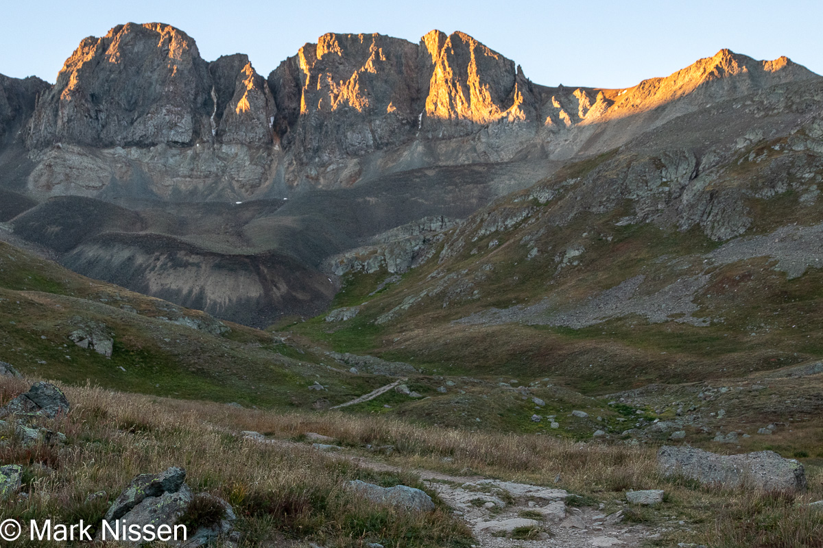
We wake to bright blue skies and comfortable temperatures. We start the day with breakfast at the campsite picnic table, enjoying the birds singing all around us. We stop at the visitor center looking for a post card to remember the park. Wandering towards Alice Lake we hope to see a bear or two before we leave but are unsuccessful. We are ready to head to our next destination, Lake City, CO. From Raton we take I-25 north, through Raton Pass getting off the interstate at Walsenburg, CO. We have the front range of mountains to the west, to the east are the Eastern Plains, running all the way to Kansas and beyond.
Leaving the interstate behind, we head west through the mountains. It is very scenic, it’s too early for fall
color but we were not anticipating fall color when we planned our trip. Once through the front range we drop into the
San Luis Valley. Off in the distance to
the north, we see the beige sand of the Great Sand Dunes NP. Continuing west, we pass through multiple small towns before making a turn to the north at South Fork, CO.
Here we follow the Rio Grande Valley to Lake City. This is the same Rio Grande that flows
through Albuquerque, NM. It doesn’t look
like the same river, it’s clear, not silt filled. The valley is very scenic, it gets added to
our list to revisit the next time we come this way.
Cinnamon Pass
Arriving at Lake City we are ready to gather tourist information for our drive on the Cinnamon Pass route, part of the Alpine Loop. Our goal is to hike Handies Peak, one of Colorado’s 14ers, a 14,000’+ mountain. This will be our first. In order to get to Handies Peak we have to take Cinnamon Pass route for 20+ miles to American Basin which leads us to one of the trailheads for Handies Peak. Arriving at the visitor center at 3:05 we find that that they closed at 3:00. The place is dark, no one to be seen. I grab whatever books are setting outside, searching them for information to get us closer to Handies Peak. Not finding much information we go to plan 'B'. We stop at one of the national forest campgrounds along the way, to pick the brain of the campground host. He strongly suggests we go all the way to American Basin then start our Handies Peak hike early, before sunrise, so we can be on our way back down before afternoon storms build up. Thanks goes to my partner, Nicida, for her video of our drive along parts of the Cinnamon Pass route and our entrance into the American Basin. Pay particular attention to the truck rocking as I negotiate the 'road'.
American Basin is 20 miles away, and it will
take over two hours to get there. There
is dispersed camping along the American Basin Road, with the Handies Peak
trailhead at the end of the road. We eagerly
listen, following his instructions to the letter.
American Basin
Part of the Cinnamon Pass route is a ‘shelf road.’ A shelf road is a notch cut into the side of the mountain slope, the width of the road. We are up close and personal with a mountain wall on one side, and open space on the other, really open, as in, the next time you touch ground you may be several hundred feet below the shelf road. I’m glad we didn’t try this in the dark. Dodging boulders and large deep potholes, many inches deep and up to tens of feet long, we still rock from side to side. Tire placement is critical, so we do not drag the bottom of the truck on the aforementioned boulders. Our drive is a slow dance, switching partners – boulders, potholes and a few flat patches. Unfortunately, I am busy driving, so I don't have any photos of this part of our adventure. This is the part of the road where two-wheel drive vehicles can go, we don’t know how they get here, but we see a few. We stop at Grizzly Gulch to stretch our legs and use the restrooms. Another four miles of picking our way along the road we arrive at the American Basin turnoff.
 |
| American Basin campsite |
Hiking Handies Peak
 |
| Barely into our hike |
 |
| Getting closer |
We see several hikers milling around a spot, what looks to be the peak, not hiking further. In fact, a few are returning. We have a long way to go, but we have seen our goal. Arriving the saddle between two peaks we emerge into the sun. It is blinding, but we don’t feel any warmth from it. We are over 13,400’, still wearing our winter coats with hats and gloves. From here the trail gets very steep.
 |
| Handies Peak in sight |
View from Handies Peak
After slightly more than three hours we arrive at Handies Peak. The 360° view is amazing. We are surrounded by mountains, being on the highest, we look down on everything. The perspective is different. We see further down each of the mountains, not just their peaks. This allows us to see layers of mountains, how they are in relation to each other. Close ones are more defined, far ones less defined due to a light haze. There are many shades of brown, reds, grays and copper. Before reaching the peak all we would see is the peaks blending together. Like seeing only people’s heads straining to look between each other to see a performer at a concert.
 |
| View from the top |
 |
| Sloan Lake, just below the peak |
 |
| Marmot |
Normally our return hikes, especially downhill, go quicker than the uphill portion, not this time. Three hours later we arrive at the camper. Along the way we take off the gloves, and hats and are down to our basic pants and shirts. We identify the chirping we heard earlier this morning, marmots. Some are quite brave, perching on nearby rocks watching us, watching and photographing them. Pikas, much smaller than marmots, are harder to spot. We catch them out of the corner of our eye as they scurry back and forth looking for food. Some seem oblivious to our presence.
Cinnamon Pass
Once back at the camper we relax. Hiking boots are the first things to come off. We relive our hike, happy to have hiked our first 14er, and happier to have accomplished it. We are over three hours from Silverton, the next town, so we make lunch. Lunch completed, we start our drive, dodging boulders and potholes on the American Basin Road. Arriving at the end of this road, we continue, on the Cinnamon Pass route. Returning the way we came means over a hundred-mile drive to Durango, tonight’s destination. Not more than 100’ up the route, a huge sign says, ‘High clearance, 4-wheel drive vehicles only, allowed beyond this point’. We are in a high clearance, 4-wheel drive vehicle so we go for it. The Garmin says it’s only four miles to the next road, which promises to be a better road. This road becomes steeper, and rougher, with bigger boulders and longer deeper potholes. All we see are Jeeps, motorcycles and OHV’s. We take it even slower than yesterday, my eyes glued to the road, picking the flattest route through anything but flat. We are able to speed up to 6 mph for brief stretches of the route, for maybe 100’ at a time. Our usual speed is 2 – 4 mph, weaving our way from one side of the road to the other. Somehow, we have accumulated a procession of vehicles behind us, we pull over making room for vehicles to pass; only a few do, the others wait for us to lead the way. I feel like the Pied Piper of Cinnamon Pass. We cross over Cinnamon Pass at 12,640’, for which the route is named, it takes over an hour to go just over four miles on this part of the route. The final descent is the most treacherous, more boulders and potholes. At the intersection going to Animas Forks, we have to make way for the line of people wanting to drive up where we just came from. The first vehicle is a 4-wheel drive pickup, they couldn’t make it, having to turn around. Frankly, if we had started going in that direction, seeing the condition of that road we would have turned around without even trying to drive it. The final part before Animas Forks turns out to be the part we remember. As we continue our drive the truck slips sideways, only a few inches but more than enough to get our attention. We are not on a shelf road where a slip could mean disaster, but any slip after what we have been driving through gets our attention. It was challenging for me having to pick the best route on a route that has no best route. It was worse for Nicida, she had a white-knuckle ride for the past hour plus.
Stopping at the restrooms for a break, one of the vehicles I
was leading, stopped. “Where did you
learn to drive like that.” “You were
fearless, you picked the smoothest route we could see.” I accepted the compliments, thinking I just
wanted to get us through the best way I could.
In the meantime, Nicida calls me to the camper, the floor, again is
littered with items that didn’t start on the floor. Worse yet is a noise, a rushing sound is
coming from around the refrigerator, leaking gas? No odor. Electrical? No odor of fried electrical
parts. Everything seems to be operating
properly. I check outside but cannot
identify where the sound is coming from.
We can’t do anything about it here, so we press on to Silverton. Another six miles of a less rocky road, but I
still have to negotiate a smooth route.
Finally, it becomes a graded road, we can speed up to 25 mph. Arriving at Silverton we stop, the sound is
still there. Still no odor. I open the storage area above the
refrigerator, the noise becomes louder.
I feel around, finding that the weather radio got turned on from all the
bouncing we were doing. Turning it off –
rushing sound disappears. What a
relief. We continue on to Durango,
breathing easier, to our campground for the next three nights.
Durango

 |
| Galloping Goose |
Laundry finished; we head into Durango. We stop in a few shops finding a few gifts for people and have hot chocolate for ourselves. We head back to the campground getting ready to catch the trains on their return run. We find a spot among the other campers, some with cameras, many with phones, everybody is smiling and waving. Tomorrow will be our turn on the last run of the train of the day, smiling and waving.
 |
| Returning train |
Durango – Silverton Railroad
 |
| All aboard |
The train slows down for tight curves and stops to take on water, because it’s a steam train. Just outside Silverton we spot a group of people panning for gold. Nobody is shouting ‘Eureka’ or doing the happy dance, telling us there’s not so much gold in ‘them thar hills.’ We spot another group fly fishing, looking like they are enjoying their time on the river.

 |
| San Juan National Forest |
 |
| Close quarters |
train is the last one of the day, “Do not miss it,” we are advised.


 |
| Animas River |
Thank you for stopping by,
Mark
Glad to hear it. If you can, it is really a wonderful place to visit.
ReplyDeleteThanks for sharing your adventures Mark! You and Nicida are certainly enjoying the great outdoors and we love your photography and videography. ~ Vince and Susan
ReplyDeleteGlad you enjoyed them. The videos are something new to my blog
ReplyDelete