Click on any image for a larger view
We are off to visit Nicida’s family in North Carolina. We are including a couple national parks because they are mostly along the way. Our national park count at the start of this trip is 18, of 62.This trip takes a bit more planning; we are visiting
relatives so we need to wear clothing that’s presentable; more than just hiking
and lounging at the campsite. The other
clothing challenge is packing for any combination of warm, cool or rainy
weather.
Being a shorter trip we fit all our food into the camper refrigerator/freezer.
This is our first trip to the southeastern US. We have been there separately; I was in grade
school, 50 plus years ago; Nicida about 17 years ago.
Packed, we are on the road by 9. The interstate is busy with cars, but there
are even more semis. Fortunately a state
highway provides a route avoiding some of the big cities. Along the way the truck passes the 100,000 mile
mark; no celebration, we have more miles to go.
Continuing east, forest reappears with muted fall colors.
Researching locations is one of my favorite things to do
when planning a trip. I find state, BLM,
National Forest and other campgrounds; avoiding RV parks, if possible. They may be out of the way but the
inconvenience of driving to them has rewarded us with wonderful experiences. This evening we stay at Beaver Dam National
Forest Campground outside of Minden, LA.
The sites are paved, have electricity, water and tables. There are 28 sites with only a few
overlooking Carey Lake. At the campground
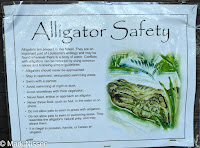
information board I spot a large ‘alligator safety sign’, certainly not a sign we
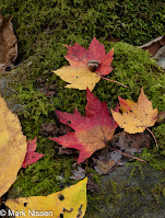
have come across in our travels to the southwest or Alaska. We did not see any alligators. The fall colors are past their peak but the remaining
leaves, backlit by the sun, are radiant.
6 PM darkness compels us to halt our fast-paced laps around the
campground.
Pay attention
We are abruptly awakened just after 6AM by loud tree cutting
machinery. Large saw blades spin, whining
up to a high pitch then bog down as they rip through tree trunks. This goes on for several minutes before a
brief respite when the process starts over again.
The trees lining the interstate inch ever higher heading
east. I have the feeling of driving down
a street of tall buildings painted in autumn tones.
Bridge construction slows traffic crossing the Mississippi
River allowing us time to see a bit life on the river.
A clear sunny day greets us as we prepare for our next
destination. We decide to find another
route to Nashville. Trees vary from full
green to muted autumn colors, to skeletons.
Cattle and sheep feed along the hillsides. The interstate is devoid of traffic but this changes
as we approach Nashville. My hope to
stay at a TN state park is dashed when I call for a site; they are full. Finding a spot at an RV park we settle in for
the night.
This morning we wake before the alarm. After breakfast, refilling the water and
emptying the waste we are on the road by 830.
Traffic on the interstate is already heavy. Trucks occupy the right lane all the way to
Knoxville. We swap positions with the
trucks; we pass them on the uphill’s, they pass us on the downhill’s.
 |
| Cades Cove, GSMNP |
Returning, the campground valley is filled with smoke,
campfire smoke. We smell it entering but
after a while it dissipates allowing us to breathe. The sun disappears around 530, cool air
rushes in as darkness returns.
Deciding to do the Cades Cove Loop road we stop at the
information tent for suggestions. We
meet Ken, one of the park volunteers. He
is excited to talk about Cades Cove and the park in general. He suggests a number of hikes and answers all
of our questions. The best suggestion he
gives us is to take the Clingman’s Dome bypass trail instead of the paved
walkway. More on this later. There is not much traffic today. We have read and been warned of several hour
long trips before ending the 11 mile loop road.
We spot a few deer relaxing in a field but no other wildlife is present
on this part of our journey.
Juney Whank Falls

Indian Creek Falls 
Tom Branch Falls
Traveling towards the Gatlinburg park entrance we come
across a black bear. Spotting us in our
camper; much larger than him he turns around scampering up into the rocks. Turkeys eye us as we pass. I wonder if they know how close we are to
Thanksgiving???
Exiting the park we continue on to Gatlinburg. The downtown area is packed with people and vehicles. It takes ten or more minutes to drive the one plus mile to the far side of the endless tourist shops. We pick up some wings for dinner eating in the truck while ‘attending’ our photography club zoom meeting.
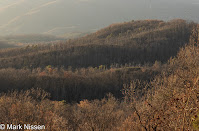
Roaring Forks Motor Trail is the last tour of the park for the day. It is quite spectacular; first climbing mountains and following ridges on the narrow one-lane road; steep walls on one side and sheer drop-offs on the other. We catch the sun lighting mountain ridges before sunset. From there we plunge to the valley following streams and visiting the homes built during the early to mid-1800’s.
I experience those initial shivers as I step out to a cold
clear morning. I see my breath. We forego having breakfast on our picnic
table; last night’s small pool of water on the bench has turned into a thin
layer of ice. After dining in the camper
we take off for the other side of the park, 60 some miles and two hours away to
meet some of Nicida’s family.
Cherokee is a small town, in a string of towns on the North Carolina side of the park. We rendezvous, stop for lunch then head off for Deep Creek trailhead. We hike up to the first falls before returning to a wide trail following a swiftly flowing river to view two other waterfalls. Living in NM for many years and central TX now I am amazed that rivers flow with such ferocity all year long.
Frost on the windshield greets me this morning. I still have my ice scraper, but I’m not
certain where it is. We are not in a
hurry so I let the truck’s defroster do the work.
We are heading back to Cades Cove stopping at a few of the original structures erected by the locals of the time. On the way we stop at several of the overlooks on the Newfound Gap Road. Our image making is quick; the wind is blowing hard and cold. Further along, back down into the forest, we spot a large black bear just popping up along the side of the road. I am past it before I am able to stop. We see it quickly crossing the road disappearing back into the forest. Turkeys again give us the eye as we pass.
A line of traffic awaits us as we join in on the Cades Cove loop road. We stop to admire the workmanship of the hand hewn logs making up the walls of the buildings. The parade of vehicles continues snaking its way along the loop road. As we approach the last section, vehicles are pulled off the road with a number of people, long lensed cameras in hand shooting something. They are excited; but nobody is leaving the vicinity of their vehicles. Pulling off the road myself I quietly ask what they are viewing – a black bear. It is rooting around; looking, scratching and digging up lunch. The line of cars gets longer until the initial people give up and leave, making room for the next batch of bear viewers. A Cades Cove bear jam; we were warned of such things.
Today, we have seen several flocks of turkeys, five black
bears, a lonesome elk, and either a fox or a coyote at the edge of the road. We are hoping for more animal sightings
tomorrow.
I start the next day with the same routine, waiting for the
defrosters to thaw the windshield frost.
We are heading off to see Clingman’s Dome, the highest mountain in the
park at 6643’.
 |
| Mingo Falls |
As we enter the park we spot a heard of elk grazing along the park road. Signs along the road warn us that no stopping on the road is allowed. Park rangers are deployed at various locations monitoring the activity.
The road to Clingman’s Dome departs the Newfound Gap Road ascending to a parking lot, filled with vehicles. After changing into our hiking gear we take off looking for the Clingman’s Dome bypass. The trail is right where Ken said it would be. The sign says a half mile to the next trail where one goes to the right then ends near the base of the observations tower on Clingman’s Dome. The trail follows along a lower section of the dome, climbing at it approaches the Appalachian Trail. From there we hiked the Appalachian Trail – maybe a quarter mile – to Clingman’s Dome. I am claiming to have hiked part of the AT, (but I’m not saying how much).
The tower is packed with viewers . We make our images returning quickly, most
are wearing masks but not everybody. The
walk back down is quite steep, we comment we are glad to have hiked the by-pass
trail, it was not as steep and very scenic.
 |
| Along the road to Clingman's Dome |
We arrive at Jordan Lake State Recreation Area. The lake is large, approaching it we notice
the lake is above its normal water line.
Trees along the edge of the lake are surrounded by water. Campsites are closed because the water is
encroaching on the sites. We have not
seen water levels like this for years.
The campground is nice, we will return at a future date.
We wake to a cool mid 30’s morning. Out for an early morning walk I see fog rolling into campsites lining the lake, I
didn’t bring my camera so the image will have to live in my memory.
Deciding to stay for another day we have a leisurely
breakfast followed by a walk to the ranger station to pay for the
campsite. From there we work on our
various projects, lunch, then hiking the campground trail. We pass through three loops of campsites,
diverting several times due to the high water level covering parts of the
trail. We never make it to the other
four loops.
 |
| Whirlygigs |
We visit family in Wilson, NC. It is a small town which in the 19th
century was known as the ‘World’s Greatest Tobacco Market’. Wilson is home to the Vollis Simpson
Whirlygig Park. There are many ‘gigs to
see, they come really come alive with the wind.
 |
| Wilson, NC |
 |
| Wilson, NC |
Rain, heavy rain is promised for the start of our return trip. Congaree NP is a 30 mile diversion from our route but with the promised rain we plan to skip it this time. Arriving at decision time; the sky, while cloudy was not precipitating; we adjust our trip to include Congaree.
It is a relatively small and certainly a lesser known park. We only found out about it through reading ‘Treasured Lands: A Photographic Odyssey Through America's National Parks’ by Q T Luong. Congaree has the largest intact expanse of old growth bottomland hardwood forest in the southeastern US. It regularly floods and dries. Each flood brings nutrients, nourishing the trees and other life within the forest. Because of this flooding cycle several species of champion trees; both state and national, thrive within the Congaree.
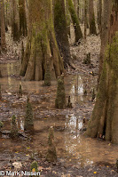
Talking is the only human sound in the forest. Forest sounds include several species of insects; chirping and whirring their specific songs. Birds are quiet making the insect sounds all the louder. We notice random ripples in the water from insects landing on and launching from its’ surface. The remaining fall colors stand out against the dark trunks of the bald cypress, water tupelo and loblolly pines. Cypress knees surround the bald cypress; scientists are not certain what purpose the knees serve the parent plant; perhaps additional anchors against flood and wind. Mosses and fungus of different colors hug the bark of fallen trees. A light shower greets us as we arrive at Weston Lake. It reminds us of the forecast for heavier rain coming in our direction. It also make the slick boardwalk from wet leaves even more slippery as we pick up the pace returning to our camper.
The ranger asks our opinion of the mosquito meter setting. He set it at ‘Mild’ from the input of some tent campers earlier in the day. We didn’t see, hear or feel any; voicing our opinion for ‘All Clear’. We query him about canoeing and kayaking. “This is a good time of the year”, “The water is down, but there is enough for both of those activities. Also, there are fewer mosquitos than in the summer”. Happy with our visit we set off for our night’s destination.
 Continuing west we run into the promised rain. At first it comes and goes; as the miles pass
the rain becomes persistent. Daylight
fades quickly under the heavy clouds and steady rain. Darkness surrounds us pulling into the RV
park. I had called, getting one of the
last two sites for the night. The night
manager escorts us to our site leaving us to set up the camper in the rain,
fortunately we have lots of practice setting up. Within 10 minutes we are plugged in, heat
going and dinner started. Each of us wake
several times this night still hearing rain.
Finally it ends, replaced by high winds which rock the camper.
This morning we have a short driving day. I am dreading the drive through Atlanta
remembering the I-75 parking lots we experienced passing through Atlanta in the
60’s and early 70’s. We cruise through
Atlanta doing 55 – 60 all the way through, dodging another bullet. Arriving at another RV park we hear that an
overnight low of 25 is expected. We stop
to pick up a large lunch hunkering down in the camper.
The next morning I see thin ice on the fallen leaves. We have breakfast in our warm camper then back on the road. Today we have another 300 mile drive ahead of us. We make it to Ruston, LA staying at Lincoln Parish Park. Christmas lights are being put up throughout the park by local businesses. Lights are glowing, powered by droning generators. The campground is nice with new paved sites overlooking the lake. We walk the trail surrounding the lake our bit of exercise for the day. Later we walk the road enjoying the Christmas vignettes.
Our last day’s drive starts with bight sunny skies but quickly
turns cloudy, then rainy for the next 150 miles of the trip. About an hour before arriving home bright
clear skies return. A wonderful way to end
our trip.
In all we put on about 3,900 miles. We shot several hundred more images and enjoyed being with family for Thanksgiving. We are now up to 20 Parks on the list of 62.
Thank you for stopping by,
Mark


These words impressed me, Mark, :"Leaves scurry across the road and back again at command of the wind. They remind me of flocking birds flying in their coordinated patterns; one turns, they all turn. A few leaves are tenaciously holding on to their branches. Trees creak as they sway." They took me and John with you on the road:-)
ReplyDeleteThank you. With that I have met my goal. I want to either; inspire you to see these places or bring you along if you can't.
ReplyDelete